[{"cd_nom": 118329, "first_year": 2009.0, "geojson_maille": {"coordinates": [[[[1.60514807, 49.029784505], [1.605630984, 49.011803629], [1.578296267, 49.011482963], [1.57780389, 49.029463734], [1.60514807, 49.029784505]]]], "type": "MultiPolygon"}, "last_year": 2017.0, "observation_number": 2, "scientific_name": "Rosa micrantha"}, {"cd_nom": 118329, "first_year": 2006.0, "geojson_maille": {"coordinates": [[[[1.714082704, 49.04898629], [1.714528071, 49.031005322], [1.687182592, 49.030709458], [1.686727754, 49.048690328], [1.714082704, 49.04898629]]]], "type": "MultiPolygon"}, "last_year": 2016.0, "observation_number": 2, "scientific_name": "Rosa micrantha"}, {"cd_nom": 118329, "first_year": 2023.0, "geojson_maille": {"coordinates": [[[[1.849267153, 49.122295207], [1.849666268, 49.104315044], [1.822281384, 49.104049969], [1.821872771, 49.122030044], [1.849267153, 49.122295207]]]], "type": "MultiPolygon"}, "last_year": 2023.0, "observation_number": 2, "scientific_name": "Rosa micrantha"}, {"cd_nom": 118329, "first_year": 2012.0, "geojson_maille": {"coordinates": [[[[2.053838541, 48.422510103], [2.054162338, 48.404518357], [2.027141101, 48.404299756], [2.026808056, 48.42229143], [2.053838541, 48.422510103]]]], "type": "MultiPolygon"}, "last_year": 2012.0, "observation_number": 1, "scientific_name": "Rosa micrantha"}, {"cd_nom": 118329, "first_year": 2023.0, "geojson_maille": {"coordinates": [[[[2.075488792, 48.72854406], [2.075807033, 48.710556708], [2.04862748, 48.710343074], [2.048299882, 48.728330355], [2.075488792, 48.72854406]]]], "type": "MultiPolygon"}, "last_year": 2023.0, "observation_number": 1, "scientific_name": "Rosa micrantha"}, {"cd_nom": 118329, "first_year": 2023.0, "geojson_maille": {"coordinates": [[[[2.162249436, 48.405331191], [2.16253604, 48.387338932], [2.135523198, 48.387145023], [2.135227351, 48.405137218], [2.162249436, 48.405331191]]]], "type": "MultiPolygon"}, "last_year": 2023.0, "observation_number": 1, "scientific_name": "Rosa micrantha"}, {"cd_nom": 118329, "first_year": 2021.0, "geojson_maille": {"coordinates": [[[[2.162822448, 48.369346428], [2.16310866, 48.351353682], [2.136114285, 48.3511599], [2.135818843, 48.369152583], [2.162822448, 48.369346428]]]], "type": "MultiPolygon"}, "last_year": 2021.0, "observation_number": 1, "scientific_name": "Rosa micrantha"}, {"cd_nom": 118329, "first_year": 2019.0, "geojson_maille": {"coordinates": [[[[2.19010323, 48.351541313], [2.190380022, 48.333548265], [2.163394676, 48.333360696], [2.16310866, 48.351353682], [2.19010323, 48.351541313]]]], "type": "MultiPolygon"}, "last_year": 2019.0, "observation_number": 1, "scientific_name": "Rosa micrantha"}, {"cd_nom": 118329, "first_year": 2013.0, "geojson_maille": {"coordinates": [[[[2.205141134, 49.14315544], [2.205416935, 49.125174648], [2.178019466, 49.124990584], [2.177734156, 49.142971315], [2.205141134, 49.14315544]]]], "type": "MultiPolygon"}, "last_year": 2013.0, "observation_number": 1, "scientific_name": "Rosa micrantha"}, {"cd_nom": 118329, "first_year": 2019.0, "geojson_maille": {"coordinates": [[[[2.214142626, 48.549630702], [2.214412217, 48.531640341], [2.187324864, 48.531458264], [2.187045979, 48.549448566], [2.214142626, 48.549630702]]]], "type": "MultiPolygon"}, "last_year": 2019.0, "observation_number": 1, "scientific_name": "Rosa micrantha"}, {"cd_nom": 118329, "first_year": 2015.0, "geojson_maille": {"coordinates": [[[[2.244092931, 48.351898121], [2.244351274, 48.333904955], [2.217365557, 48.333729684], [2.217097989, 48.351722792], [2.244092931, 48.351898121]]]], "type": "MultiPolygon"}, "last_year": 2015.0, "observation_number": 1, "scientific_name": "Rosa micrantha"}, {"cd_nom": 118329, "first_year": 2016.0, "geojson_maille": {"coordinates": [[[[2.27108805, 48.352067297], [2.271337168, 48.334074076], [2.244351274, 48.333904955], [2.244092931, 48.351898121], [2.27108805, 48.352067297]]]], "type": "MultiPolygon"}, "last_year": 2016.0, "observation_number": 1, "scientific_name": "Rosa micrantha"}, {"cd_nom": 118329, "first_year": 2016.0, "geojson_maille": {"coordinates": [[[[2.324847968, 48.370380283], [2.325078793, 48.352387197], [2.29808334, 48.352230323], [2.297843283, 48.370223357], [2.324847968, 48.370380283]]]], "type": "MultiPolygon"}, "last_year": 2019.0, "observation_number": 2, "scientific_name": "Rosa micrantha"}, {"cd_nom": 118329, "first_year": 2015.0, "geojson_maille": {"coordinates": [[[[2.325078793, 48.352387197], [2.325309461, 48.334393871], [2.298323232, 48.334237048], [2.29808334, 48.352230323], [2.325078793, 48.352387197]]]], "type": "MultiPolygon"}, "last_year": 2015.0, "observation_number": 1, "scientific_name": "Rosa micrantha"}, {"cd_nom": 118329, "first_year": 2015.0, "geojson_maille": {"coordinates": [[[[2.347164081, 48.748328117], [2.347388892, 48.730340454], [2.320198079, 48.730188687], [2.319963903, 48.748176301], [2.347164081, 48.748328117]]]], "type": "MultiPolygon"}, "last_year": 2015.0, "observation_number": 1, "scientific_name": "Rosa micrantha"}, {"cd_nom": 118329, "first_year": 2015.0, "geojson_maille": {"coordinates": [[[[2.350964919, 48.442501155], [2.35118712, 48.424508999], [2.324154544, 48.424358079], [2.323923086, 48.442350184], [2.350964919, 48.442501155]]]], "type": "MultiPolygon"}, "last_year": 2015.0, "observation_number": 1, "scientific_name": "Rosa micrantha"}, {"cd_nom": 118329, "first_year": 2022.0, "geojson_maille": {"coordinates": [[[[2.377367197, 48.496621067], [2.377580579, 48.478629619], [2.35052006, 48.478484715], [2.350297402, 48.496476116], [2.377367197, 48.496621067]]]], "type": "MultiPolygon"}, "last_year": 2022.0, "observation_number": 1, "scientific_name": "Rosa micrantha"}, {"cd_nom": 118329, "first_year": 2022.0, "geojson_maille": {"coordinates": [[[[2.380129801, 48.262713007], [2.380341294, 48.244718409], [2.35340079, 48.244574123], [2.353180103, 48.262568673], [2.380129801, 48.262713007]]]], "type": "MultiPolygon"}, "last_year": 2022.0, "observation_number": 1, "scientific_name": "Rosa micrantha"}, {"cd_nom": 118329, "first_year": 2022.0, "geojson_maille": {"coordinates": [[[[2.404437139, 48.496759851], [2.404641244, 48.478768357], [2.377580579, 48.478629619], [2.377367197, 48.496621067], [2.404437139, 48.496759851]]]], "type": "MultiPolygon"}, "last_year": 2022.0, "observation_number": 1, "scientific_name": "Rosa micrantha"}, {"cd_nom": 118329, "first_year": 1999.0, "geojson_maille": {"coordinates": [[[[2.459133711, 48.443043419], [2.459318882, 48.425051086], [2.432285736, 48.424924804], [2.432091307, 48.442917096], [2.459133711, 48.443043419]]]], "type": "MultiPolygon"}, "last_year": 1999.0, "observation_number": 1, "scientific_name": "Rosa micrantha"}, {"cd_nom": 118329, "first_year": 2023.0, "geojson_maille": {"coordinates": [[[[2.485647777, 48.497139195], [2.485824053, 48.479147576], [2.458762987, 48.479027335], [2.458577435, 48.497018915], [2.485647777, 48.497139195]]]], "type": "MultiPolygon"}, "last_year": 2023.0, "observation_number": 1, "scientific_name": "Rosa micrantha"}, {"cd_nom": 118329, "first_year": 2023.0, "geojson_maille": {"coordinates": [[[[2.512718241, 48.497253307], [2.512885239, 48.479261651], [2.485824053, 48.479147576], [2.485647777, 48.497139195], [2.512718241, 48.497253307]]]], "type": "MultiPolygon"}, "last_year": 2023.0, "observation_number": 1, "scientific_name": "Rosa micrantha"}, {"cd_nom": 118329, "first_year": 2018.0, "geojson_maille": {"coordinates": [[[[2.536451505, 48.87512507], [2.536611521, 48.857139117], [2.509354058, 48.85703046], [2.509184629, 48.875016378], [2.536451505, 48.87512507]]]], "type": "MultiPolygon"}, "last_year": 2018.0, "observation_number": 2, "scientific_name": "Rosa micrantha"}, {"cd_nom": 118329, "first_year": 2005.0, "geojson_maille": {"coordinates": [[[[2.567896483, 48.371515699], [2.568044217, 48.35352224], [2.541047571, 48.353420731], [2.540890603, 48.371414156], [2.567896483, 48.371515699]]]], "type": "MultiPolygon"}, "last_year": 2005.0, "observation_number": 1, "scientific_name": "Rosa micrantha"}, {"cd_nom": 118329, "first_year": 1997.0, "geojson_maille": {"coordinates": [[[[2.568044217, 48.35352224], [2.568191851, 48.335528541], [2.541204431, 48.335427066], [2.541047571, 48.353420731], [2.568044217, 48.35352224]]]], "type": "MultiPolygon"}, "last_year": 2013.0, "observation_number": 2, "scientific_name": "Rosa micrantha"}, {"cd_nom": 118329, "first_year": 2005.0, "geojson_maille": {"coordinates": [[[[2.594902463, 48.371611087], [2.595040964, 48.353617597], [2.568044217, 48.35352224], [2.567896483, 48.371515699], [2.594902463, 48.371611087]]]], "type": "MultiPolygon"}, "last_year": 2005.0, "observation_number": 3, "scientific_name": "Rosa micrantha"}, {"cd_nom": 118329, "first_year": 2020.0, "geojson_maille": {"coordinates": [[[[2.621649735, 48.407686632], [2.621779181, 48.389693599], [2.594763866, 48.389604335], [2.594625175, 48.407597339], [2.621649735, 48.407686632]]]], "type": "MultiPolygon"}, "last_year": 2020.0, "observation_number": 1, "scientific_name": "Rosa micrantha"}, {"cd_nom": 118329, "first_year": 2023.0, "geojson_maille": {"coordinates": [[[[2.622166987, 48.335713043], [2.622296079, 48.317719044], [2.595317684, 48.317629898], [2.595179371, 48.335623867], [2.622166987, 48.335713043]]]], "type": "MultiPolygon"}, "last_year": 2023.0, "observation_number": 2, "scientific_name": "Rosa micrantha"}, {"cd_nom": 118329, "first_year": 2015.0, "geojson_maille": {"coordinates": [[[[2.702825629, 48.389924454], [2.702927268, 48.371931101], [2.675920947, 48.371860328], [2.675810068, 48.389853658], [2.702825629, 48.389924454]]]], "type": "MultiPolygon"}, "last_year": 2015.0, "observation_number": 1, "scientific_name": "Rosa micrantha"}, {"cd_nom": 118329, "first_year": 2020.0, "geojson_maille": {"coordinates": [[[[2.757851124, 48.174111279], [2.757933605, 48.156115101], [2.731037537, 48.156056867], [2.730945892, 48.174053026], [2.757851124, 48.174111279]]]], "type": "MultiPolygon"}, "last_year": 2020.0, "observation_number": 1, "scientific_name": "Rosa micrantha"}, {"cd_nom": 118329, "first_year": 2013.0, "geojson_maille": {"coordinates": [[[[2.784020493, 48.354112841], [2.784094311, 48.336118948], [2.757106261, 48.336066672], [2.757023215, 48.354060548], [2.784020493, 48.354112841]]]], "type": "MultiPolygon"}, "last_year": 2013.0, "observation_number": 1, "scientific_name": "Rosa micrantha"}, {"cd_nom": 118329, "first_year": 2019.0, "geojson_maille": {"coordinates": [[[[2.784094311, 48.336118948], [2.784168079, 48.318124816], [2.75718925, 48.318072558], [2.757106261, 48.336066672], [2.784094311, 48.336118948]]]], "type": "MultiPolygon"}, "last_year": 2019.0, "observation_number": 1, "scientific_name": "Rosa micrantha"}, {"cd_nom": 118329, "first_year": 2023.0, "geojson_maille": {"coordinates": [[[[2.811082412, 48.336165074], [2.811146959, 48.318170927], [2.784168079, 48.318124816], [2.784094311, 48.336118948], [2.811082412, 48.336165074]]]], "type": "MultiPolygon"}, "last_year": 2023.0, "observation_number": 1, "scientific_name": "Rosa micrantha"}, {"cd_nom": 118329, "first_year": 2014.0, "geojson_maille": {"coordinates": [[[[2.811211462, 48.300176544], [2.811275921, 48.282181926], [2.784315464, 48.282135846], [2.784241797, 48.300130448], [2.811211462, 48.300176544]]]], "type": "MultiPolygon"}, "last_year": 2014.0, "observation_number": 1, "scientific_name": "Rosa micrantha"}, {"cd_nom": 118329, "first_year": 2019.0, "geojson_maille": {"coordinates": [[[[2.811275921, 48.282181926], [2.811340336, 48.264187075], [2.784389081, 48.26414101], [2.784315464, 48.282135846], [2.811275921, 48.282181926]]]], "type": "MultiPolygon"}, "last_year": 2019.0, "observation_number": 1, "scientific_name": "Rosa micrantha"}, {"cd_nom": 118329, "first_year": 2022.0, "geojson_maille": {"coordinates": [[[[2.891899165, 48.408240868], [2.89193615, 48.390247653], [2.864920235, 48.39021995], [2.864874003, 48.408213156], [2.891899165, 48.408240868]]]], "type": "MultiPolygon"}, "last_year": 2022.0, "observation_number": 1, "scientific_name": "Rosa micrantha"}, {"cd_nom": 118329, "first_year": 2022.0, "geojson_maille": {"coordinates": [[[[2.892010044, 48.354260492], [2.892046954, 48.336266551], [2.86505874, 48.336238875], [2.865012603, 48.354232807], [2.892010044, 48.354260492]]]], "type": "MultiPolygon"}, "last_year": 2022.0, "observation_number": 1, "scientific_name": "Rosa micrantha"}, {"cd_nom": 118329, "first_year": 2016.0, "geojson_maille": {"coordinates": [[[[2.918252873, 48.840021845], [2.918281073, 48.822035024], [2.891041461, 48.822013307], [2.891003861, 48.84000012], [2.918252873, 48.840021845]]]], "type": "MultiPolygon"}, "last_year": 2016.0, "observation_number": 1, "scientific_name": "Rosa micrantha"}, {"cd_nom": 118329, "first_year": 2019.0, "geojson_maille": {"coordinates": [[[[2.91884102, 48.462240608], [2.918868816, 48.444248128], [2.891825118, 48.44422656], [2.891788057, 48.462219033], [2.91884102, 48.462240608]]]], "type": "MultiPolygon"}, "last_year": 2019.0, "observation_number": 1, "scientific_name": "Rosa micrantha"}, {"cd_nom": 118329, "first_year": 2014.0, "geojson_maille": {"coordinates": [[[[2.94538883, 48.94795217], [2.945407709, 48.929967109], [2.918111579, 48.929951566], [2.918083262, 48.947936621], [2.94538883, 48.94795217]]]], "type": "MultiPolygon"}, "last_year": 2014.0, "observation_number": 1, "scientific_name": "Rosa micrantha"}, {"cd_nom": 118329, "first_year": 2015.0, "geojson_maille": {"coordinates": [[[[2.972974775, 48.408287055], [2.972984022, 48.390293824], [2.94596805, 48.39028459], [2.945949557, 48.408277817], [2.972974775, 48.408287055]]]], "type": "MultiPolygon"}, "last_year": 2015.0, "observation_number": 2, "scientific_name": "Rosa micrantha"}, {"cd_nom": 118329, "first_year": 2019.0, "geojson_maille": {"coordinates": [[[[3.053976548, 48.336303451], [3.053958106, 48.318309259], [3.026979056, 48.318318481], [3.026988277, 48.336312677], [3.053976548, 48.336303451]]]], "type": "MultiPolygon"}, "last_year": 2019.0, "observation_number": 1, "scientific_name": "Rosa micrantha"}, {"cd_nom": 118329, "first_year": 2015.0, "geojson_maille": {"coordinates": [[[[3.05401347, 48.372291118], [3.053995003, 48.354297405], [3.026997505, 48.354306633], [3.027006738, 48.37230035], [3.05401347, 48.372291118]]]], "type": "MultiPolygon"}, "last_year": 2015.0, "observation_number": 1, "scientific_name": "Rosa micrantha"}, {"cd_nom": 118329, "first_year": 2017.0, "geojson_maille": {"coordinates": [[[[3.216794854, 48.552029406], [3.216720477, 48.534038256], [3.189630529, 48.534084549], [3.189695609, 48.552075714], [3.216794854, 48.552029406]]]], "type": "MultiPolygon"}, "last_year": 2017.0, "observation_number": 1, "scientific_name": "Rosa micrantha"}, {"cd_nom": 118329, "first_year": 2018.0, "geojson_maille": {"coordinates": [[[[3.271179317, 48.587899711], [3.271086219, 48.56990912], [3.243977779, 48.569967796], [3.244061568, 48.587958406], [3.271179317, 48.587899711]]]], "type": "MultiPolygon"}, "last_year": 2018.0, "observation_number": 1, "scientific_name": "Rosa micrantha"}, {"cd_nom": 118329, "first_year": 2019.0, "geojson_maille": {"coordinates": [[[[3.351927852, 48.497731347], [3.35180724, 48.479739533], [3.324745462, 48.479816612], [3.324856797, 48.497808451], [3.351927852, 48.497731347]]]], "type": "MultiPolygon"}, "last_year": 2019.0, "observation_number": 1, "scientific_name": "Rosa micrantha"}]
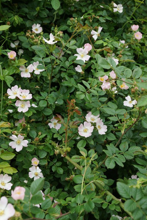
Avertissement : La carte présentée ne correspond qu'à l'état actuel des connaissances
et ne peut être considérée comme exhaustive. Cette carte est une retranscription en temps réel des
contributions de chacun sur la base de données et toute nouvelle donnée est à ce titre intéressante,
même pour les espèces les plus communes.