[{"cd_nom": 82909, "first_year": 2021.0, "geojson_maille": {"coordinates": [[[[1.521580528, 49.0827433], [1.522092894, 49.064763684], [1.494730813, 49.06442401], [1.494208967, 49.082403514], [1.521580528, 49.0827433]]]], "type": "MultiPolygon"}, "last_year": 2021.0, "observation_number": 1, "scientific_name": "Anthericum ramosum"}, {"cd_nom": 82909, "first_year": 2021.0, "geojson_maille": {"coordinates": [[[[1.549455329, 49.065097128], [1.549957864, 49.047117089], [1.522604904, 49.046783755], [1.522092894, 49.064763684], [1.549455329, 49.065097128]]]], "type": "MultiPolygon"}, "last_year": 2024.0, "observation_number": 3, "scientific_name": "Anthericum ramosum"}, {"cd_nom": 82909, "first_year": 2009.0, "geojson_maille": {"coordinates": [[[[1.60514807, 49.029784505], [1.605630984, 49.011803629], [1.578296267, 49.011482963], [1.57780389, 49.029463734], [1.60514807, 49.029784505]]]], "type": "MultiPolygon"}, "last_year": 2017.0, "observation_number": 2, "scientific_name": "Anthericum ramosum"}, {"cd_nom": 82909, "first_year": 2018.0, "geojson_maille": {"coordinates": [[[[1.630595498, 49.102019843], [1.631070263, 49.084040118], [1.603697319, 49.083725262], [1.603213065, 49.101704884], [1.630595498, 49.102019843]]]], "type": "MultiPolygon"}, "last_year": 2024.0, "observation_number": 6, "scientific_name": "Anthericum ramosum"}, {"cd_nom": 82909, "first_year": 2023.0, "geojson_maille": {"coordinates": [[[[1.631070263, 49.084040118], [1.631544699, 49.066060076], [1.604181238, 49.065745324], [1.603697319, 49.083725262], [1.631070263, 49.084040118]]]], "type": "MultiPolygon"}, "last_year": 2023.0, "observation_number": 1, "scientific_name": "Anthericum ramosum"}, {"cd_nom": 82909, "first_year": 2023.0, "geojson_maille": {"coordinates": [[[[1.657512662, 49.120308076], [1.65797826, 49.102328567], [1.630595498, 49.102019843], [1.630120404, 49.119999251], [1.657512662, 49.120308076]]]], "type": "MultiPolygon"}, "last_year": 2023.0, "observation_number": 1, "scientific_name": "Anthericum ramosum"}, {"cd_nom": 82909, "first_year": 2017.0, "geojson_maille": {"coordinates": [[[[1.65797826, 49.102328567], [1.658443536, 49.08434874], [1.631070263, 49.084040118], [1.630595498, 49.102019843], [1.65797826, 49.102328567]]]], "type": "MultiPolygon"}, "last_year": 2024.0, "observation_number": 6, "scientific_name": "Anthericum ramosum"}, {"cd_nom": 82909, "first_year": 2023.0, "geojson_maille": {"coordinates": [[[[1.685817131, 49.084651129], [1.6862726, 49.066670886], [1.658908488, 49.066368596], [1.658443536, 49.08434874], [1.685817131, 49.084651129]]]], "type": "MultiPolygon"}, "last_year": 2023.0, "observation_number": 1, "scientific_name": "Anthericum ramosum"}, {"cd_nom": 82909, "first_year": 2018.0, "geojson_maille": {"coordinates": [[[[1.741437962, 49.049276021], [1.741873859, 49.031294958], [1.714528071, 49.031005322], [1.714082704, 49.04898629], [1.741437962, 49.049276021]]]], "type": "MultiPolygon"}, "last_year": 2018.0, "observation_number": 1, "scientific_name": "Anthericum ramosum"}, {"cd_nom": 82909, "first_year": 2015.0, "geojson_maille": {"coordinates": [[[[1.770497454, 48.977633042], [1.7709227, 48.959650654], [1.74361443, 48.959367618], [1.743179739, 48.977349913], [1.770497454, 48.977633042]]]], "type": "MultiPolygon"}, "last_year": 2015.0, "observation_number": 1, "scientific_name": "Anthericum ramosum"}, {"cd_nom": 82909, "first_year": 2010.0, "geojson_maille": {"coordinates": [[[[1.881705826, 48.888786633], [1.882091951, 48.870802396], [1.854829679, 48.870544661], [1.85443414, 48.888528814], [1.881705826, 48.888786633]]]], "type": "MultiPolygon"}, "last_year": 2017.0, "observation_number": 4, "scientific_name": "Anthericum ramosum"}, {"cd_nom": 82909, "first_year": 2005.0, "geojson_maille": {"coordinates": [[[[2.204865142, 49.16113591], [2.205141134, 49.14315544], [2.177734156, 49.142971315], [2.177448649, 49.160951725], [2.204865142, 49.16113591]]]], "type": "MultiPolygon"}, "last_year": 2017.0, "observation_number": 11, "scientific_name": "Anthericum ramosum"}, {"cd_nom": 82909, "first_year": 2018.0, "geojson_maille": {"coordinates": [[[[2.324847968, 48.370380283], [2.325078793, 48.352387197], [2.29808334, 48.352230323], [2.297843283, 48.370223357], [2.324847968, 48.370380283]]]], "type": "MultiPolygon"}, "last_year": 2020.0, "observation_number": 2, "scientific_name": "Anthericum ramosum"}, {"cd_nom": 82909, "first_year": 2018.0, "geojson_maille": {"coordinates": [[[[2.432285736, 48.424924804], [2.432480031, 48.406932264], [2.405456269, 48.406799866], [2.405252722, 48.424792362], [2.432285736, 48.424924804]]]], "type": "MultiPolygon"}, "last_year": 2018.0, "observation_number": 1, "scientific_name": "Anthericum ramosum"}, {"cd_nom": 82909, "first_year": 2018.0, "geojson_maille": {"coordinates": [[[[2.432480031, 48.406932264], [2.432674194, 48.388939479], [2.405659677, 48.388807124], [2.405456269, 48.406799866], [2.432480031, 48.406932264]]]], "type": "MultiPolygon"}, "last_year": 2021.0, "observation_number": 2, "scientific_name": "Anthericum ramosum"}, {"cd_nom": 82909, "first_year": 2021.0, "geojson_maille": {"coordinates": [[[[2.56760071, 48.407501888], [2.567748647, 48.389508915], [2.540733529, 48.38940734], [2.540576346, 48.407400279], [2.56760071, 48.407501888]]]], "type": "MultiPolygon"}, "last_year": 2022.0, "observation_number": 2, "scientific_name": "Anthericum ramosum"}, {"cd_nom": 82909, "first_year": 2019.0, "geojson_maille": {"coordinates": [[[[2.567896483, 48.371515699], [2.568044217, 48.35352224], [2.541047571, 48.353420731], [2.540890603, 48.371414156], [2.567896483, 48.371515699]]]], "type": "MultiPolygon"}, "last_year": 2019.0, "observation_number": 1, "scientific_name": "Anthericum ramosum"}, {"cd_nom": 82909, "first_year": 2022.0, "geojson_maille": {"coordinates": [[[[2.594486389, 48.425590097], [2.594625175, 48.407597339], [2.56760071, 48.407501888], [2.567452672, 48.425494615], [2.594486389, 48.425590097]]]], "type": "MultiPolygon"}, "last_year": 2022.0, "observation_number": 1, "scientific_name": "Anthericum ramosum"}, {"cd_nom": 82909, "first_year": 2015.0, "geojson_maille": {"coordinates": [[[[2.594625175, 48.407597339], [2.594763866, 48.389604335], [2.567748647, 48.389508915], [2.56760071, 48.407501888], [2.594625175, 48.407597339]]]], "type": "MultiPolygon"}, "last_year": 2024.0, "observation_number": 10, "scientific_name": "Anthericum ramosum"}, {"cd_nom": 82909, "first_year": 2022.0, "geojson_maille": {"coordinates": [[[[2.594763866, 48.389604335], [2.594902463, 48.371611087], [2.567896483, 48.371515699], [2.567748647, 48.389508915], [2.594763866, 48.389604335]]]], "type": "MultiPolygon"}, "last_year": 2022.0, "observation_number": 1, "scientific_name": "Anthericum ramosum"}, {"cd_nom": 82909, "first_year": 2022.0, "geojson_maille": {"coordinates": [[[[2.621520201, 48.425679419], [2.621649735, 48.407686632], [2.594625175, 48.407597339], [2.594486389, 48.425590097], [2.621520201, 48.425679419]]]], "type": "MultiPolygon"}, "last_year": 2022.0, "observation_number": 1, "scientific_name": "Anthericum ramosum"}, {"cd_nom": 82909, "first_year": 2019.0, "geojson_maille": {"coordinates": [[[[2.621649735, 48.407686632], [2.621779181, 48.389693599], [2.594763866, 48.389604335], [2.594625175, 48.407597339], [2.621649735, 48.407686632]]]], "type": "MultiPolygon"}, "last_year": 2022.0, "observation_number": 2, "scientific_name": "Anthericum ramosum"}, {"cd_nom": 82909, "first_year": 2018.0, "geojson_maille": {"coordinates": [[[[2.621908538, 48.371700321], [2.622037806, 48.353706802], [2.595040964, 48.353617597], [2.594902463, 48.371611087], [2.621908538, 48.371700321]]]], "type": "MultiPolygon"}, "last_year": 2018.0, "observation_number": 1, "scientific_name": "Anthericum ramosum"}, {"cd_nom": 82909, "first_year": 2018.0, "geojson_maille": {"coordinates": [[[[2.648554101, 48.425762582], [2.648674384, 48.407769767], [2.621649735, 48.407686632], [2.621520201, 48.425679419], [2.648554101, 48.425762582]]]], "type": "MultiPolygon"}, "last_year": 2018.0, "observation_number": 1, "scientific_name": "Anthericum ramosum"}, {"cd_nom": 82909, "first_year": 2024.0, "geojson_maille": {"coordinates": [[[[2.648674384, 48.407769767], [2.648794583, 48.389776706], [2.621779181, 48.389693599], [2.621649735, 48.407686632], [2.648674384, 48.407769767]]]], "type": "MultiPolygon"}, "last_year": 2024.0, "observation_number": 1, "scientific_name": "Anthericum ramosum"}, {"cd_nom": 82909, "first_year": 2019.0, "geojson_maille": {"coordinates": [[[[2.648794583, 48.389776706], [2.648914701, 48.371783402], [2.621908538, 48.371700321], [2.621779181, 48.389693599], [2.648794583, 48.389776706]]]], "type": "MultiPolygon"}, "last_year": 2019.0, "observation_number": 1, "scientific_name": "Anthericum ramosum"}, {"cd_nom": 82909, "first_year": 2015.0, "geojson_maille": {"coordinates": [[[[2.675365796, 48.46182452], [2.675476978, 48.443832177], [2.648433737, 48.443755149], [2.64831329, 48.461747467], [2.675365796, 48.46182452]]]], "type": "MultiPolygon"}, "last_year": 2018.0, "observation_number": 3, "scientific_name": "Anthericum ramosum"}, {"cd_nom": 82909, "first_year": 2010.0, "geojson_maille": {"coordinates": [[[[2.675476978, 48.443832177], [2.675588084, 48.425839584], [2.648554101, 48.425762582], [2.648433737, 48.443755149], [2.675476978, 48.443832177]]]], "type": "MultiPolygon"}, "last_year": 2024.0, "observation_number": 13, "scientific_name": "Anthericum ramosum"}, {"cd_nom": 82909, "first_year": 2010.0, "geojson_maille": {"coordinates": [[[[2.675588084, 48.425839584], [2.675699114, 48.407846744], [2.648674384, 48.407769767], [2.648554101, 48.425762582], [2.675588084, 48.425839584]]]], "type": "MultiPolygon"}, "last_year": 2013.0, "observation_number": 3, "scientific_name": "Anthericum ramosum"}, {"cd_nom": 82909, "first_year": 2017.0, "geojson_maille": {"coordinates": [[[[2.702520296, 48.443903042], [2.702622143, 48.425910426], [2.675588084, 48.425839584], [2.675476978, 48.443832177], [2.702520296, 48.443903042]]]], "type": "MultiPolygon"}, "last_year": 2024.0, "observation_number": 6, "scientific_name": "Anthericum ramosum"}, {"cd_nom": 82909, "first_year": 2010.0, "geojson_maille": {"coordinates": [[[[2.702622143, 48.425910426], [2.702723921, 48.407917563], [2.675699114, 48.407846744], [2.675588084, 48.425839584], [2.702622143, 48.425910426]]]], "type": "MultiPolygon"}, "last_year": 2010.0, "observation_number": 1, "scientific_name": "Anthericum ramosum"}, {"cd_nom": 82909, "first_year": 2015.0, "geojson_maille": {"coordinates": [[[[2.702825629, 48.389924454], [2.702927268, 48.371931101], [2.675920947, 48.371860328], [2.675810068, 48.389853658], [2.702825629, 48.389924454]]]], "type": "MultiPolygon"}, "last_year": 2017.0, "observation_number": 3, "scientific_name": "Anthericum ramosum"}, {"cd_nom": 82909, "first_year": 2016.0, "geojson_maille": {"coordinates": [[[[2.703028837, 48.353937506], [2.703130337, 48.33594367], [2.676142476, 48.335872944], [2.676031749, 48.353866756], [2.703028837, 48.353937506]]]], "type": "MultiPolygon"}, "last_year": 2024.0, "observation_number": 2, "scientific_name": "Anthericum ramosum"}, {"cd_nom": 82909, "first_year": 2015.0, "geojson_maille": {"coordinates": [[[[2.729563683, 48.443967746], [2.729656272, 48.425975108], [2.702622143, 48.425910426], [2.702520296, 48.443903042], [2.729563683, 48.443967746]]]], "type": "MultiPolygon"}, "last_year": 2021.0, "observation_number": 7, "scientific_name": "Anthericum ramosum"}, {"cd_nom": 82909, "first_year": 2015.0, "geojson_maille": {"coordinates": [[[[2.72984126, 48.389989093], [2.729933659, 48.371995719], [2.702927268, 48.371931101], [2.702825629, 48.389924454], [2.72984126, 48.389989093]]]], "type": "MultiPolygon"}, "last_year": 2020.0, "observation_number": 12, "scientific_name": "Anthericum ramosum"}, {"cd_nom": 82909, "first_year": 2017.0, "geojson_maille": {"coordinates": [[[[2.729933659, 48.371995719], [2.730025995, 48.354002103], [2.703028837, 48.353937506], [2.702927268, 48.371931101], [2.729933659, 48.371995719]]]], "type": "MultiPolygon"}, "last_year": 2018.0, "observation_number": 7, "scientific_name": "Anthericum ramosum"}, {"cd_nom": 82909, "first_year": 2017.0, "geojson_maille": {"coordinates": [[[[2.756856954, 48.390047577], [2.756940113, 48.372054183], [2.729933659, 48.371995719], [2.72984126, 48.389989093], [2.756856954, 48.390047577]]]], "type": "MultiPolygon"}, "last_year": 2024.0, "observation_number": 11, "scientific_name": "Anthericum ramosum"}, {"cd_nom": 82909, "first_year": 2021.0, "geojson_maille": {"coordinates": [[[[2.756940113, 48.372054183], [2.757023215, 48.354060548], [2.730025995, 48.354002103], [2.729933659, 48.371995719], [2.756940113, 48.372054183]]]], "type": "MultiPolygon"}, "last_year": 2021.0, "observation_number": 2, "scientific_name": "Anthericum ramosum"}, {"cd_nom": 82909, "first_year": 2010.0, "geojson_maille": {"coordinates": [[[[2.757437876, 48.264088803], [2.757520639, 48.246093753], [2.730578686, 48.246035423], [2.730486728, 48.264030454], [2.757437876, 48.264088803]]]], "type": "MultiPolygon"}, "last_year": 2017.0, "observation_number": 3, "scientific_name": "Anthericum ramosum"}, {"cd_nom": 82909, "first_year": 2024.0, "geojson_maille": {"coordinates": [[[[2.757520639, 48.246093753], [2.757603345, 48.228098474], [2.730670581, 48.228040163], [2.730578686, 48.246035423], [2.757520639, 48.246093753]]]], "type": "MultiPolygon"}, "last_year": 2024.0, "observation_number": 1, "scientific_name": "Anthericum ramosum"}, {"cd_nom": 82909, "first_year": 2018.0, "geojson_maille": {"coordinates": [[[[2.783946624, 48.372106494], [2.784020493, 48.354112841], [2.757023215, 48.354060548], [2.756940113, 48.372054183], [2.783946624, 48.372106494]]]], "type": "MultiPolygon"}, "last_year": 2019.0, "observation_number": 2, "scientific_name": "Anthericum ramosum"}, {"cd_nom": 82909, "first_year": 2013.0, "geojson_maille": {"coordinates": [[[[2.811082412, 48.336165074], [2.811146959, 48.318170927], [2.784168079, 48.318124816], [2.784094311, 48.336118948], [2.811082412, 48.336165074]]]], "type": "MultiPolygon"}, "last_year": 2022.0, "observation_number": 19, "scientific_name": "Anthericum ramosum"}, {"cd_nom": 82909, "first_year": 2017.0, "geojson_maille": {"coordinates": [[[[3.351927852, 48.497731347], [3.35180724, 48.479739533], [3.324745462, 48.479816612], [3.324856797, 48.497808451], [3.351927852, 48.497731347]]]], "type": "MultiPolygon"}, "last_year": 2020.0, "observation_number": 3, "scientific_name": "Anthericum ramosum"}, {"cd_nom": 82909, "first_year": 2015.0, "geojson_maille": {"coordinates": [[[[3.352048547, 48.515722906], [3.351927852, 48.497731347], [3.324856797, 48.497808451], [3.324968208, 48.515800035], [3.352048547, 48.515722906]]]], "type": "MultiPolygon"}, "last_year": 2015.0, "observation_number": 1, "scientific_name": "Anthericum ramosum"}]
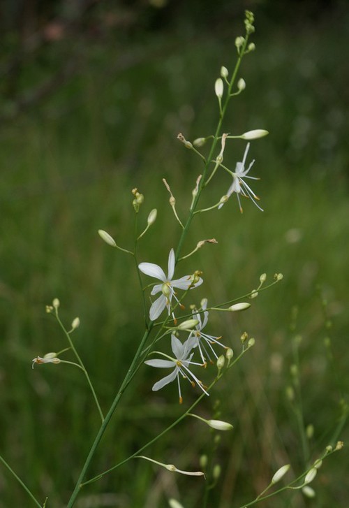
Avertissement : La carte présentée ne correspond qu'à l'état actuel des connaissances
et ne peut être considérée comme exhaustive. Cette carte est une retranscription en temps réel des
contributions de chacun sur la base de données et toute nouvelle donnée est à ce titre intéressante,
même pour les espèces les plus communes.